August 3rd 2022
This adventure was laid out by the Vancouver Island tourism department, they have a number of different adventures, they all seem to start in Victoria and branch out into different areas of the island, our trip to Tofino a couple of weeks ago was part of one of the planned routes. This adventure explores around the southern part of the island, the map below shows the route, and every marker on the map is a recommended point of interest.

We had a number of items that we wanted to see, most of them being in the Port Renfrew area. We left the coach before eight o’clock and headed south on the Trans Canada Hwy. to catch Hwy. 18 near Duncan, actually this is the same journey we took last week on our route to Bear Lake, only a little further down the road we are now turning south. On to the Pacific Marine Road toward Port Renfrew, this is a paved road but it was originally a logging road, as many of the roads in British Columbia were, this was a twisty route with many elevation changes and numerous one lane bridges over creeks and rivers. It was 14°C (55°F) and partially overcast when we started out, and the further we moved toward the coast the weather turned from partially to fully overcast and the temperature actually was dropping.
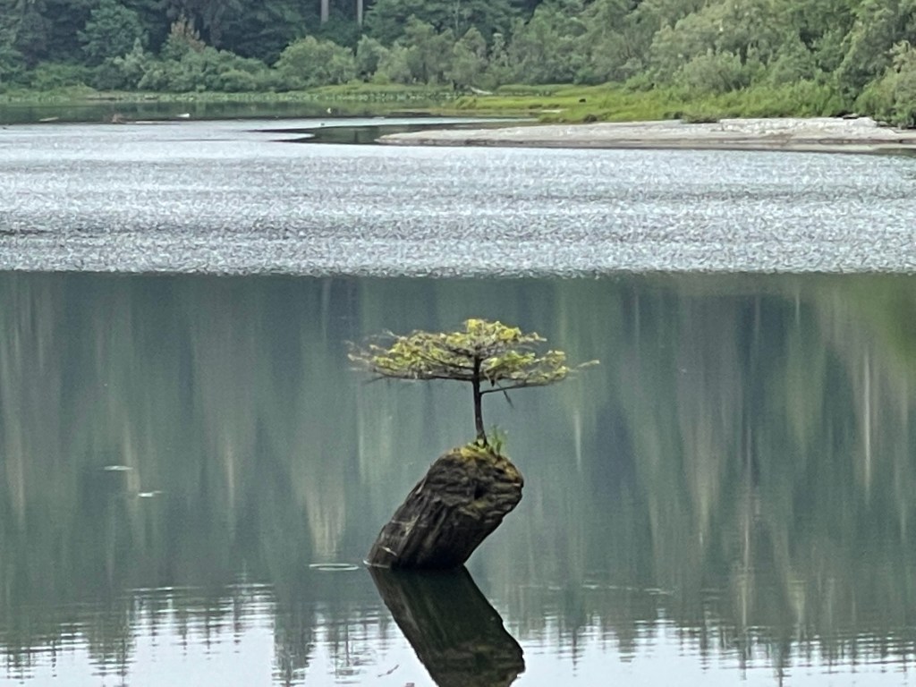
We made a couple of quick stops to snap a photo here and there, but the photo above is one of the most amazing, it is referred to as the Bonsai tree of Fairy Lake, it is almost impossible to image, and when I had seen photos I actually thought it was a fake or had been photoshopped.

As we moved further toward the coast we entered Port Renfrew, a quaint little village, on the coast of the island at the point where the Pacific Ocean and the Straits of Juan de Fuca meet. And directly south of the village a few kilometers was the Juan de Fuca Provincial Park and the Botanical Beach. Of course nothing comes easy as we started our hike to the beach, and lets just say that my “All Trails” app clocked us at over 5 kilometers (3 miles) of hiking and wandering through the tidal pools on the ocean floor, before climbing the hill to the parking lot.

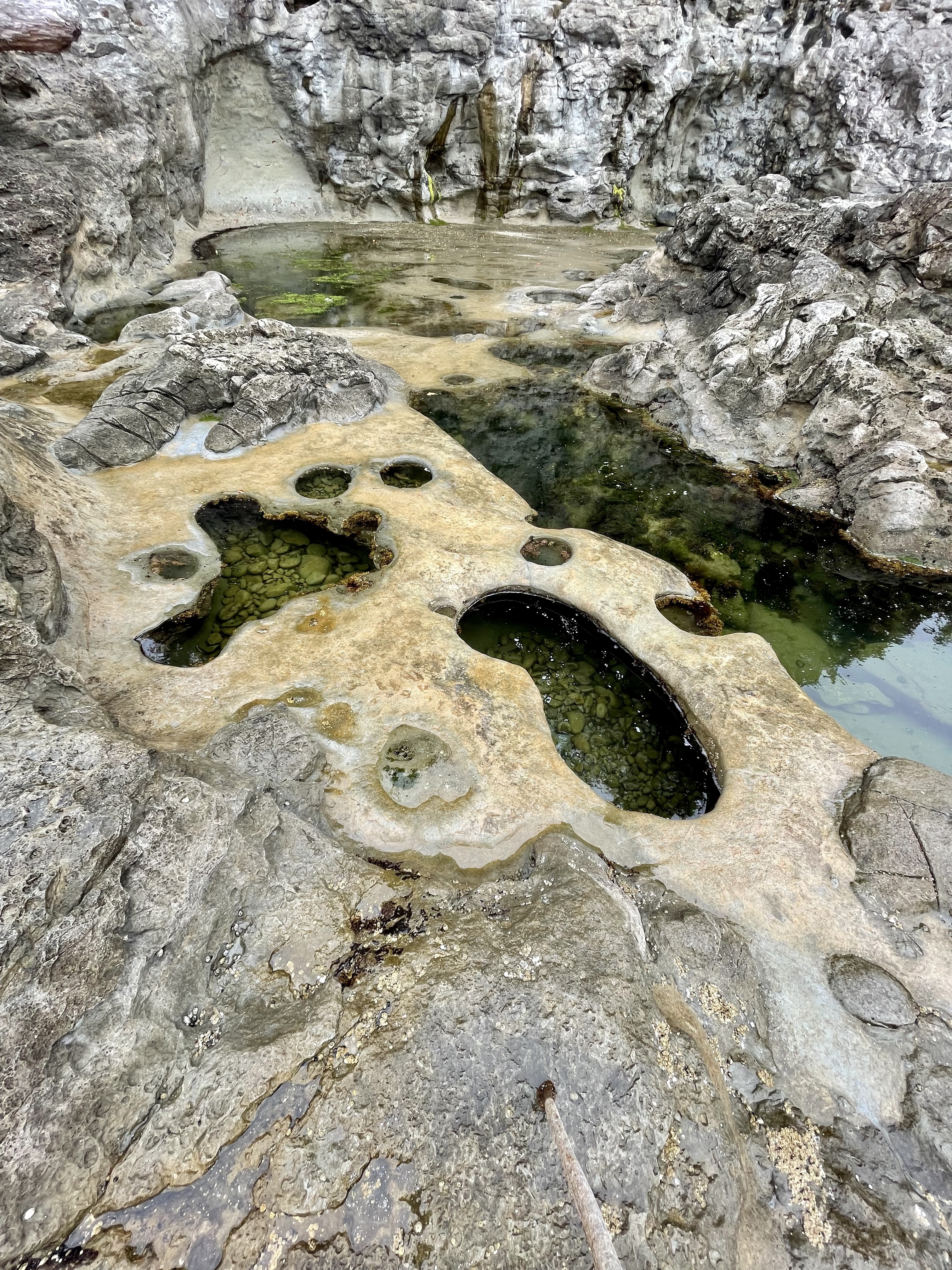

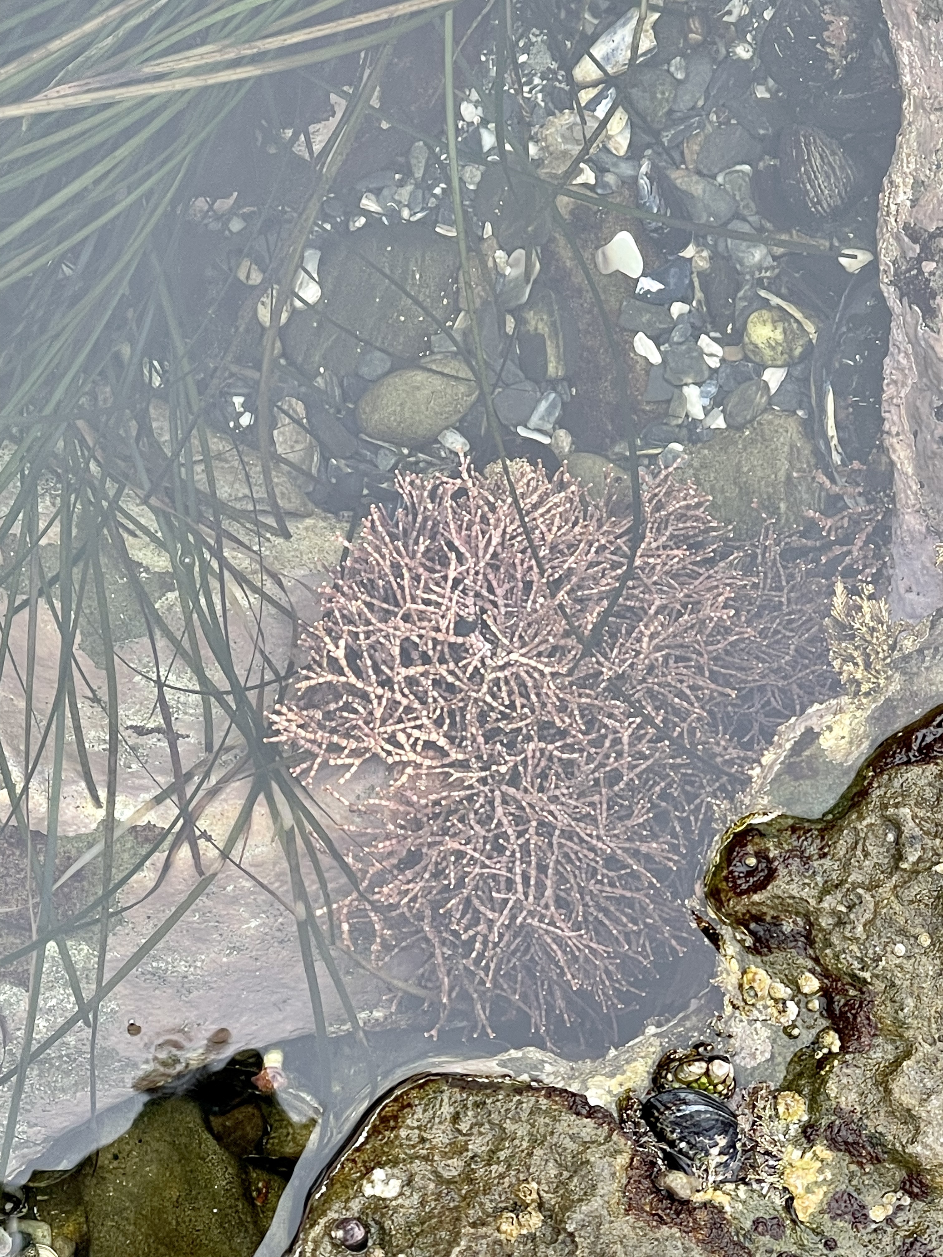
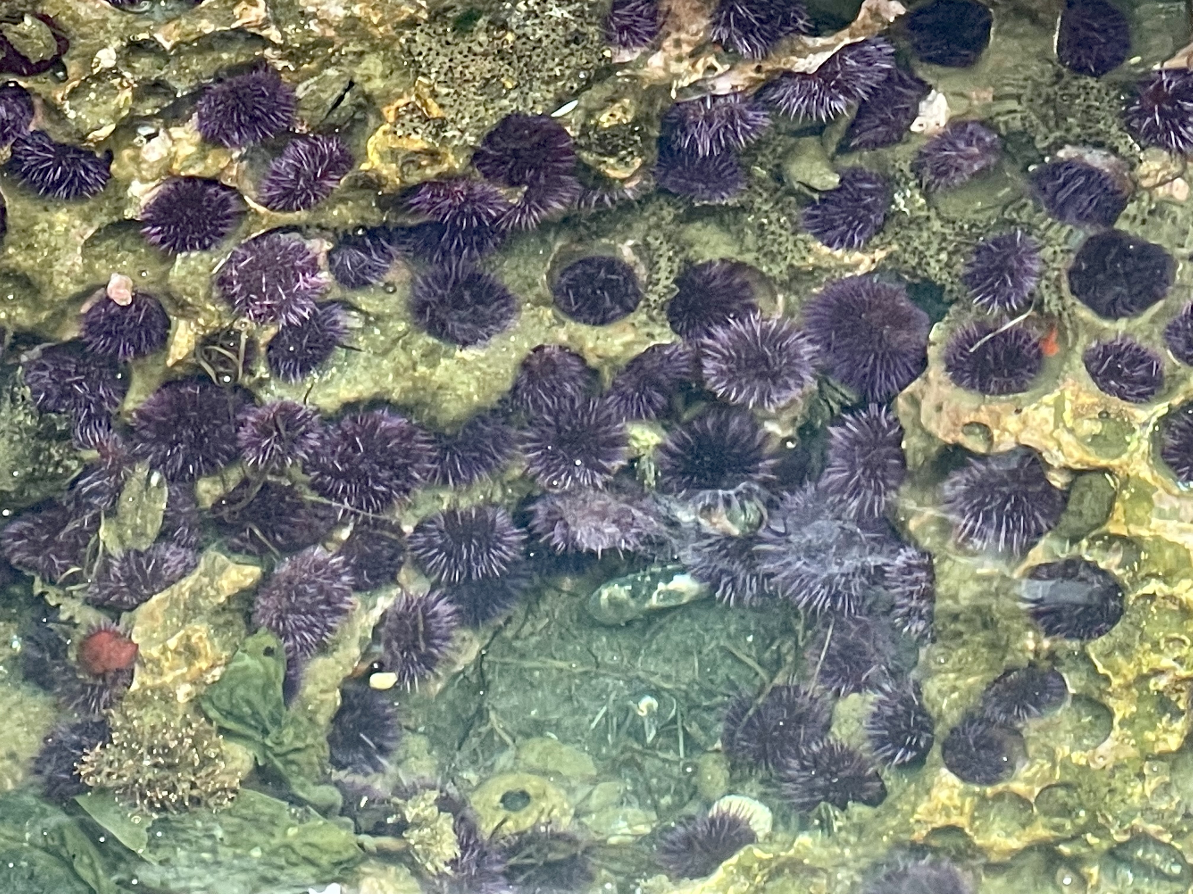


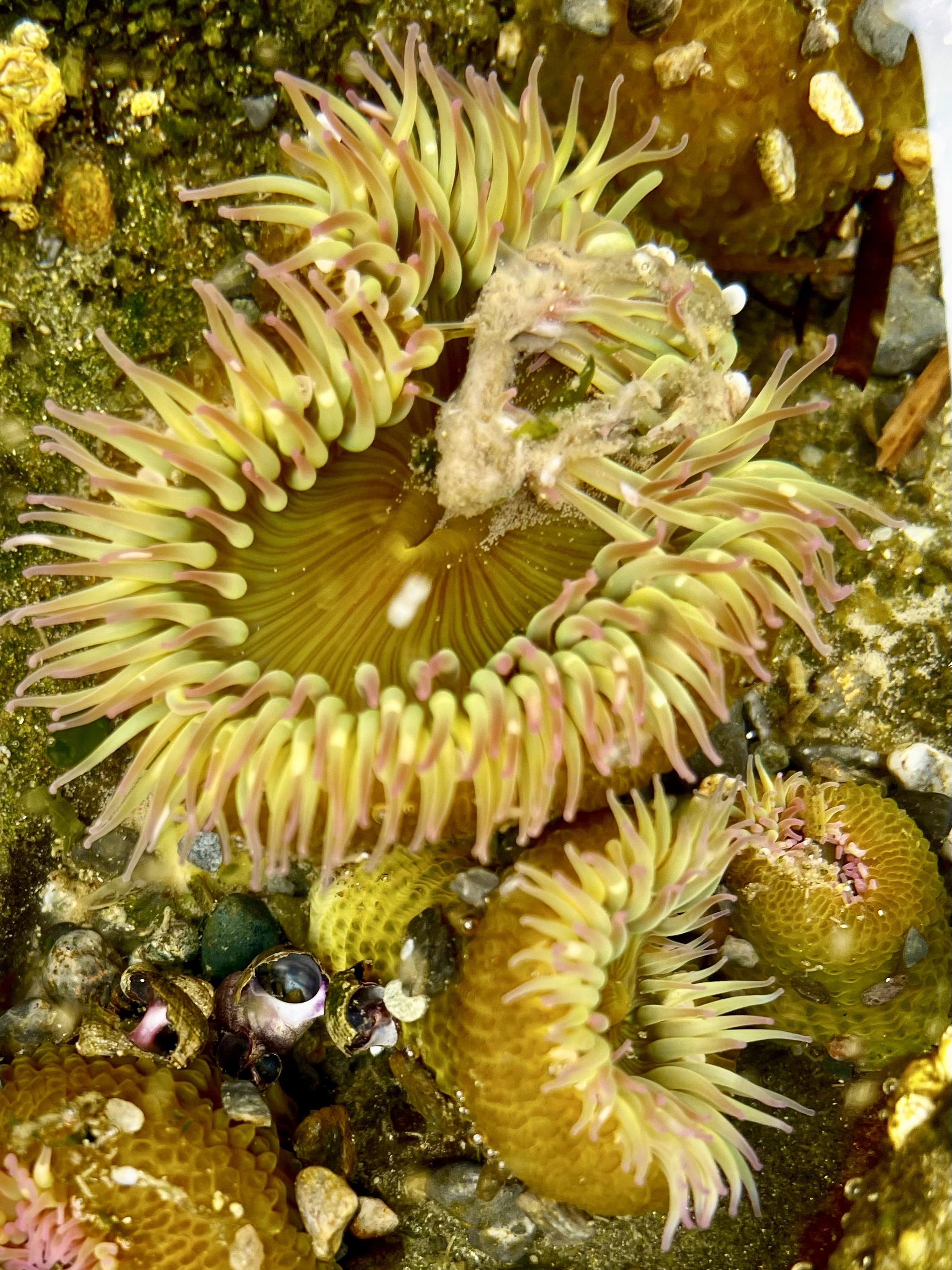
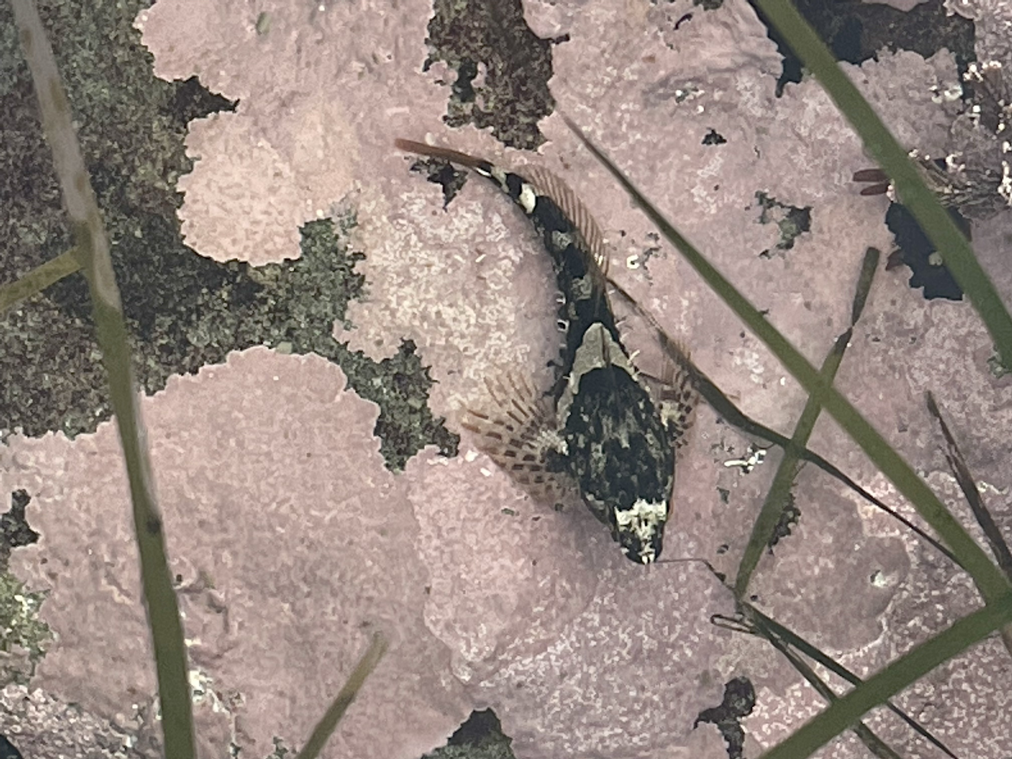
As you can see the tidal pools were teaming with sea life and we spent most of the morning wandering on the ocean floor observing the area, obviously it was low tide at the time, but there is a very amazing micro world to observe in almost every pool.

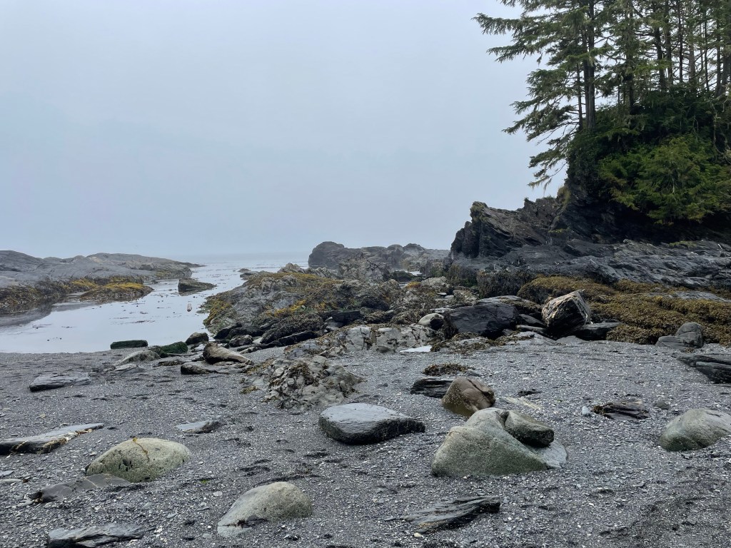
The hiking path took us to both Bounty Bay and Botanical Beach, both areas were stunning, and showed the ruggedness of the Pacific coast, the tides here are high in this area, and as you wander between the pools it is hard to imagine them being under water, but rock, sand, and logs let you know you are on the west coast.

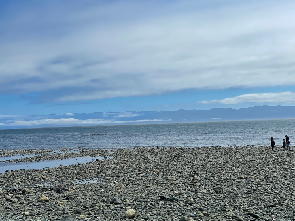
After making it back to the truck we decided to stop for some lunch at the Renfrew Pub, one of the local watering holes, and if the weather had been better offered some great out door dining on a huge patio. We settled on indoor dining and I had a grilled salmon burger while Laurie had rockfish and chips. As we enjoyed lunch we decided to drive the rest of the circle route which would take us to the most southern tip of the island and give us views of Washington States, in fact we could actual see the snow capped peaks of Mount Olympus.
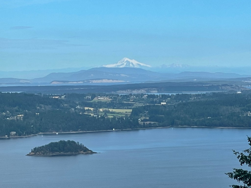
We continued our journey through the village of Sook, a small harbour town, but with a larger population because of its proximity to Victoria and moved along the coast until reaching the Trans Canada Hwy where we turned north and headed back toward the campground. We did not go into Victoria, that will be a day trip on its own as there a lot exploration in that area alone, but as we headed north we remembered a couple of scenic overlooks that we had bypassed on our last trip in the coach. As you can see the sky’s were much clearer away from the ocean, and the temperatures were much warmer as well.
The traffic was busy on the Trans Canada Hwy, we assume just rush hour out of Victoria, so a bit of a slow journey back up to Duncan, where we stopped and purchased so groceries at the blue sign store. Then the fifteen minutes back to the coach. An excellent route, if you were to stop at every suggested area it would be a two day trip, but if you just are hitting the natural features as we did one day is all you need. The costal road (Hwy 14) was a slow twisting, rough road. We laughed every time we seen a travel trailer being bounced almost air borne by some of the dips, cellular service was nonexistent for much of the journey, which was fine, but be sure to download you information before you go, I had downloaded the All Trails maps before leaving. And know when the tides are best for viewing!
Blog 436
Discover more from The Buchanan's Rolling Down The Road
Subscribe to get the latest posts sent to your email.

Happy to hear that you had a great outing. Great pictures- thanks for sharing.
LikeLiked by 1 person