Summer 2022
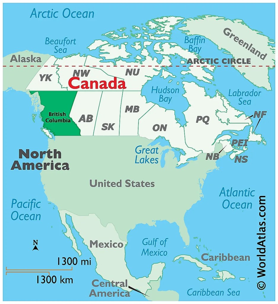
British Columbia is the third largest province in Canada, and for our American friends yes it is over 30% larger than Texas, it was the sixth province to join the dominion, it has a population of 5.2 million and 50% of the population lives in the metropolitan of Vancouver making Vancouver the third largest city in Canada. It is located on the west coast of Canada, and is bounded on the north by the Yukon and the Northwest Territories, on the east by the province of Alberta, the south by the States of Montana, Idaho, and Washington and on the west by the Pacific Ocean and the Alaskan panhandle. the province is 1180 kilometers (730 miles) from north to south and 1030 kilometers (640 miles) at it widest point, and the length of shoreline is over 27,000 kilometers (16,500 miles).
My first impression of British Columbia was that it is nothing like I remembered from nearly fifty years ago, yes it’s been close to fifty years since my last visit to British Columbia, not something I’m particular proud of, but it is a fact, and a lot of things have changed, and we are just on Vancouver Island right now. As I write this blog it doesn’t appear that we will spend any time on the mainland this year, we had hoped to spend the month of October there, but with the chance of a Mexican caravan, the mainland will have to wait for another visit.
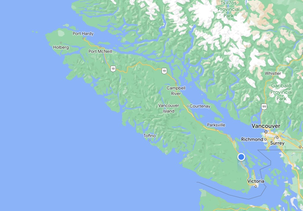
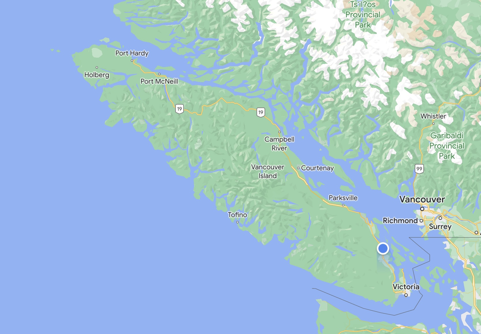
Our time in British Columbia will be confined to Vancouver Island, so that is where I will direct the balance of this blog. The capital of British Columbia is the city of Victoria and it is located on the southern tip of Vancouver Island. Here are some statistics on the island 456 kilometers (283 miles) long and at it’s widest point 100 kilometers (62 miles) wide, the population of the island is just under 865,000 of which 397,000 live in the metropolitan area of Victoria. The island only has one main highway from Victoria on the south to Port Harding at the north, and is located on the east side of the island. Driving it is fun in the coach with stop lights every few miles, the highway has a concrete divider so it is not uncommon to have to drive to U-turns located at some intersections to access desired businesses or destinations.
Vancouver Island is located in the southwestern corner of the province of British Columbia. It is separated from the mainland of British Columbia by Johnstone Strait and Queen Charlotte Strait on the north and northeast, and by the Strait of Georgia on the southeast, which along with the Strait of Juan de Fuca along its southwest separate it from the United States. West of the island is the open Pacific Ocean, while to its north is Queen Charlotte Sound. The Straits of Georgia and Juan de Fuca are now officially part of the Salish Sea, which also includes Puget Sound.
The fauna of Vancouver Island is similar to that found on the mainland coast, with some notable exceptions and additions. For example, mountain goats, moose, coyotes, porcupines, skunks, chipmunks, and numerous species of small mammals, while plentiful on the mainland, are absent from Vancouver Island. Grizzly bears are absent from the island, where black bears are prevalent, but in 2016, a pair of grizzlies were sighted swimming between smaller islands off the coast near Port McNeill. Vancouver Island does support most of Canada’s Roosevelt elk, however, and several mammal species and subspecies, such as the Vancouver Island marmot are unique to the island. Columbian black-tailed deer are plentiful, even in suburban areas such as in Greater Victoria, as well as the native Douglas squirrels. The Eastern grey squirrel is found in the south and is considered invasive for its voracious appetite and scaring away of the Douglas squirrels. The island has the most concentrated population of cougars in North America. The Vancouver Island wolf, a subspecies of grey wolf, is found only on the north part of the island. Harbour seals and river otters are common.
Resident orcas live in two major groups, one in the waters of the south island and one in the north, while a third group of transient orcas roam much farther and avoid the resident orcas. Residents are watched from a distance and are numbered, with many being named as well. Humpback whales and gray whales are often seen on their migration between Alaskan waters where they feed in the summer and southern waters such as around California and Mexico where they give birth in the winter.
The island’s rivers, lakes, and coastal regions are renowned for their fisheries of trout, salmon, and steelhead.
Vancouver Island lies in the temperate rainforest biome. On the southern and eastern portions of the island, this is characterized by Douglas fir, western red cedar, arbutus (or madrone), Garry oak, salal, Oregon grape, and manzanita; moreover, Vancouver Island is the location where the Douglas fir was first recorded by Archibald Menzies. Vancouver Island is also the location where some of the tallest Douglas fir were recorded. This southeastern portion of the island is the most heavily populated region of Vancouver Island and a major area for recreation. The northern, western, and most of the central portions of the island are home to the coniferous “big trees” associated with British Columbia’s coast – western hemlock, western red cedar, Pacific silver fir, yellow cedar, Douglas fir, grand fir, Sitka spruce, and western white pine. It is also characterised by bigleaf maple, red alder, sword fern, and red huckleberry.
The Vancouver Island Ranges run most of the length of the island, dividing it into a wet and rugged west coast and a drier, more rolling east coast. The highest point in these ranges and on the island is the Golden Hinde, at 2,195 m (7,201 ft). Located near the centre of Vancouver Island in 2,500 km2 (970 sq mi) Strathcona Provincial Park, it is part of a group of peaks that include the only glaciers on the island, the largest of which is the Comox Glacier. The west coast shoreline is rugged and in many places mountainous, characterized by its many fjords, bays, and inlets. The interior of the island has many lakes (Kennedy Lake, north of Ucluelet, is the largest) and rivers.
I have tried to tip toe around this topic but I have to just put it out there, the people on Vancouver Island have been for the most part the most unfriendly people that we have ever experienced, they even make New Yorker’s seem friendly, and we know New Yorkers. I understood when we decided to visit here that many in the western provinces did not like people from the eastern provinces, but this has been border line hostile. Even meeting someone on a local street and saying hello, will in most cases at best get you a cold glare, and when dealing with businesses’, that has been a horrendous experience. We will leave the Island with some great experiences but none have to do with the people of BC, in fact I think BC could just stand for “bring cash“, as everything here is over priced, and the whole experience has left us debating about our plans to come back to explore the mainland, I guess only time will tell on that topic, but whether it was at the campground or just meeting people in public, people have been cold at best and in many situations have been just plain nasty. There I said it, beautiful country but unlike Canada’s east coast, the people on the island are not an asset.
Blog 447
Discover more from The Buchanan's Rolling Down The Road
Subscribe to get the latest posts sent to your email.

Brian thanks for speaking your truth – that’s unfortunate that your “people experience” wasn’t as positive as the places you visited.
LikeLike